
Bielde:Rottumeroog Rottumerplaat 6.53663E 53.54001N.jpg

Grööte fon dissen Foarbekiek: 800 × 599 Pixele. Uur Aplöösengen: 320 × 240 Pixele | 640 × 479 Pixele | 1.024 × 766 Pixele | 1.280 × 958 Pixele.
Bielde in hooge Aplöösenge (1.280 × 958 Pixel, Doatäigrööte: 444 KB, MIME-Typ: image/jpeg)
| Beskrieuwenge |
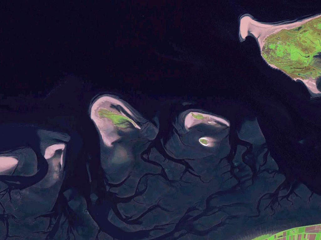
English: Some West Frisian Islands (Netherlands) and some East Frisian Islands (Germany), from left to right: part of Schiermonnikoog, Simonszand, Rottumerplaat, Rottumeroog (north) with Zuiderduintjes (south) and part of Borkum. |
|||
| Doatum | vor 2005 | |||
| Wälle |
English: NASA World Wind screenshot |
|||
| Autor | – (NASA World Wind) | |||
| Genehmigung (Weiternutzung dieser Datei) |
|

| Annotations | This image is annotated: View the annotations at Commons |
Doatäiversione
Klik ap n Tiedpunkt, uum disse Version tou leeden.
| Version fon | Foarbekiekbielde | Höchte un Bratte | Benutser | Kommentoar | |
|---|---|---|---|---|---|
| aktuäl | 19:06, 13. Okt 2013 | | 1.280 × 958 (444 KB) | Jahoe | stretched contrast |
| 13:53, 15. Moa 2005 |  | 1.280 × 958 (59 KB) | Rex | NASA World Wind screenshot. {{PD-USGov-NASA}} Category:Maps of The Netherlands |
Doatäiferweendenge
Ju foulgjende Siede ferwoant disse Doatäi:
Globoale Doatäinutsenge
Die nachfolgenden anderen Wikis verwenden diese Datei:
- Verwendung auf arz.wikipedia.org
- Verwendung auf br.wikipedia.org
- Verwendung auf ca.wikipedia.org
- Verwendung auf ceb.wikipedia.org
- Verwendung auf de.wikipedia.org
- Verwendung auf en.wikipedia.org
- Verwendung auf eo.wikipedia.org
- Verwendung auf es.wikipedia.org
- Verwendung auf frr.wikipedia.org
- Verwendung auf fr.wikipedia.org
- Verwendung auf fy.wikipedia.org
- Verwendung auf nds-nl.wikipedia.org
- Verwendung auf nds.wikipedia.org
- Verwendung auf nl.wikipedia.org
- Verwendung auf nn.wikipedia.org
- Verwendung auf no.wikipedia.org
- Verwendung auf ru.wikipedia.org
- Verwendung auf www.wikidata.org